Database
IMECH_Database is built on data collected from many sources, many different forms such as: measuring stations in the National station system, rainfall data, radar data, real-time satellite cloud image data, inherited data from other domestic and foreign topics.
IMECH_Database includes the following types of data:
- Terrain data:
+ DEM map 30m x 30m taken from the center...
+ DEM map 90m x 90m taken from the center...
+ DEM map 30m x 30m taken from the center... America....
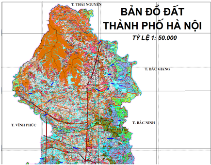
There are also several toned maps of hilly areas with a ratio of 1:50 000 and plain areas with a ratio of 1:1 0000 collected from domestic and foreign topics.
IMECH_Database includes the following types of data:
- Terrain data:
+ DEM map 30m x 30m taken from the center...
+ DEM map 90m x 90m taken from the center...
+ DEM map 30m x 30m taken from the center... America....
There are also several toned maps of hilly areas with a ratio of 1:50 000 and plain areas with a ratio of 1:1 0000 collected from domestic and foreign topics.
- Map of land use, land classification map:
+ Map of the current state of land use provided by the Institute of meteorological Science and Climate Change. This is a map with a ratio of 1:50 000. The soil classification map provided by the Pyongyang Institute for AgriculturalIzation has a ratio of 1:50 000.
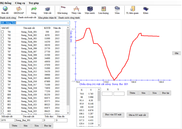
- Riverbed data:
+ Cross-section data on the Red River – Thai Binh system is established to have 33 rivers with 67 tributaries and a total of 980 cross sections across the basin.
+ Cross-section data on the Huong River system is set to have 13 rivers with 197 cross sections.
+ Cross-section figures on the Kone River system are set....
+ Cross-section data on the Mekong Delta river system is set...
- Meteorological data and riverside works:
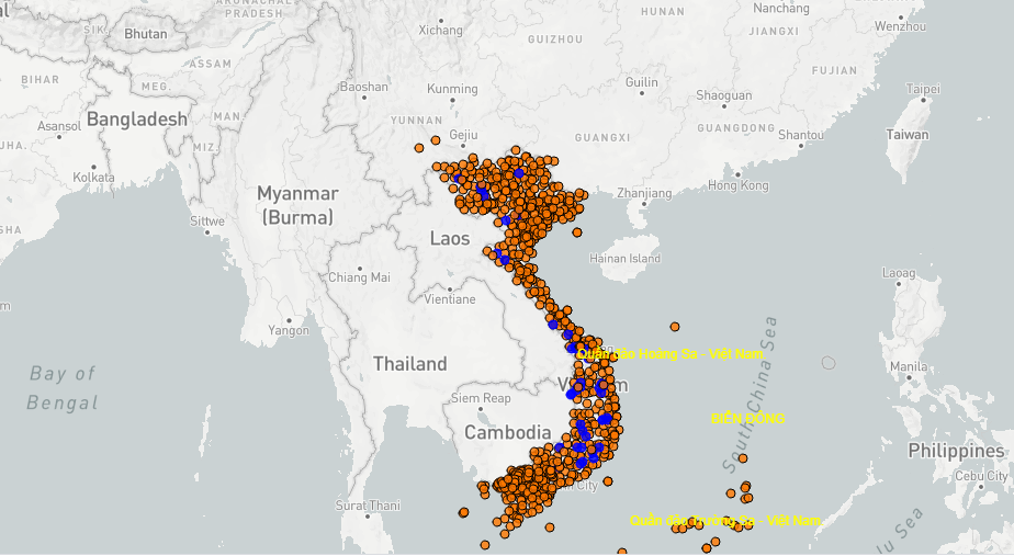
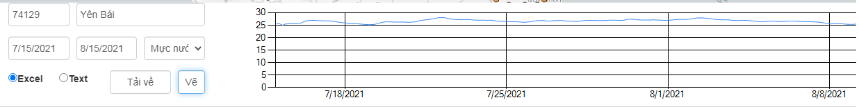
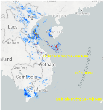
+ Meteorological data of measuring stations nationwide (national stations + local stations): .. station
+ Rainfall figures, there are data that last from 1956 to the present
+ Some local measuring stations, rainfall figures, flow, concentration of substances at a specified range.
+ Data from the system of large reservoirs of the country in real time such as: reservoir water level, flow into the lake, outlet discharge ,...
+ Forecast data from major models in the world: GFS, ECMWF, ICON, Meteoblue, NCHMF, GEM - Canada, CMA - China
- The database set is built for the management and use of data to calculate options quickly and conveniently.
- The list of basins with simple information is selected and entered into the database by field.
- Data can be obtained in text or exel format.